
2010 Hurricane Season "Strange"
Storms were numerous, but U.S. had "hurricane repellent," expert says.
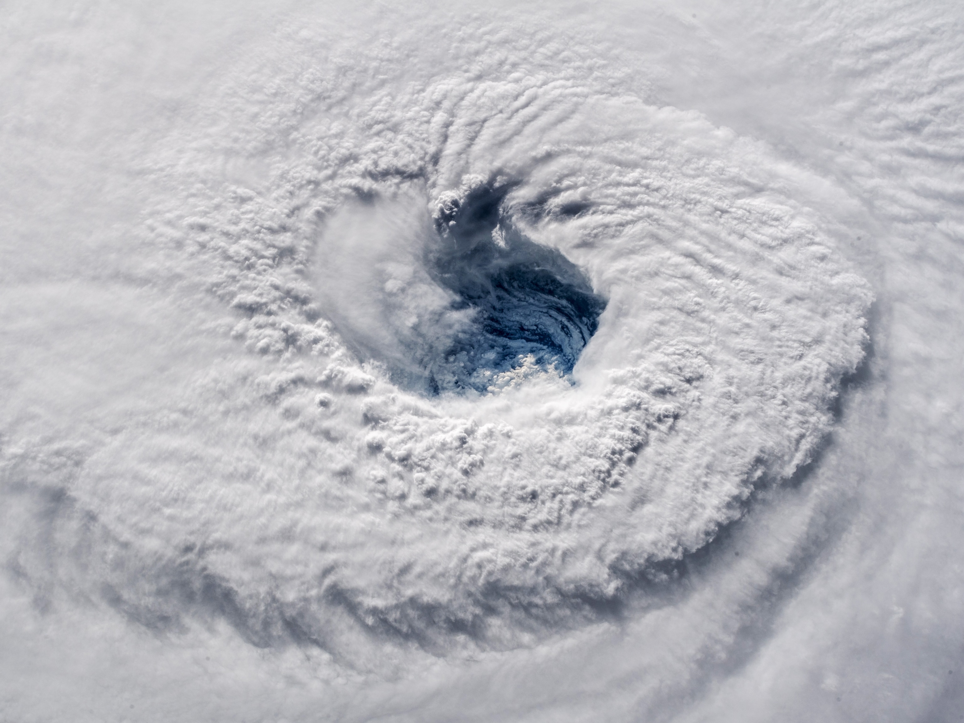
If you think the 2010 Atlantic hurricane season was a quiet one, think again: This year's season, which ends today, has actually been one of the most active on record, experts say.
The 2010 season produced 19 named tropical storms, tying this season with 1995 and 1887 for the third-most active since record-keeping began. (See before-and-after pictures of sites affected by Hurricane Katrina.)
A dozen of the 2010 storms developed into hurricanes, with winds of at least 74 miles (119 kilometers) an hour. Five of those hurricanes became major storms, with winds exceeding 110 miles (177 kilometers) an hour.
But tropical storm Bonnie—which crossed southeastern Florida in late July and then dissipated in the Gulf of Mexico—was the only 2010 storm to touch the U.S. coastline. That's because persistent low-pressure systems moving off the U.S. East Coast steered the storms away.
"This was a strange, strange season," said Keith Blackwell, a meteorologist at the University of South Alabama's Coastal Weather Research Center in Mobile.
"It was almost like we had a hurricane repellent over the U.S. East Coast and Gulf Coast. The storms were out there, but they just didn't approach the U.S."
Lots of Hurricanes, Few U.S. Landfalls
During the early part of the 2010 season in June and July, upper-level winds known as wind shear hindered the development of tropical storms.
Wind shear diminished as the hurricane season reached its peak in mid-August, and a flurry of storms formed. But low-pressure systems kept the storms at sea.
This year was the first time in recorded history that as many as 12 named hurricanes formed in the Atlantic without at least one of them making a U.S. landfall, said forecasters Phil Klotzbach and William Gray at Colorado State University.
"That stands out as the most remarkable feature of the 2010 season," said Jeff Masters, meteorological director for the Weather Underground website.
"Normally you'd expect four hurricanes to hit the U.S. with that kind of activity."
Canada, Mexico Took Hurricane Hits
The Coastal Weather Research Center's Blackwell said he wasn't sure why so many low-pressure systems developed in the Atlantic. But even with such systems in play, luck was also a factor in the lack of U.S. landfalls.
In some cases, even a few days' difference in when the storms formed would have led to very different outcomes, he said. For example, Hurricane Earl, which gave North Carolina a near-miss in early September, could have made landfall if it had approached the Outer Banks a day or two earlier.
"We were just very fortunate," Blackwell said.
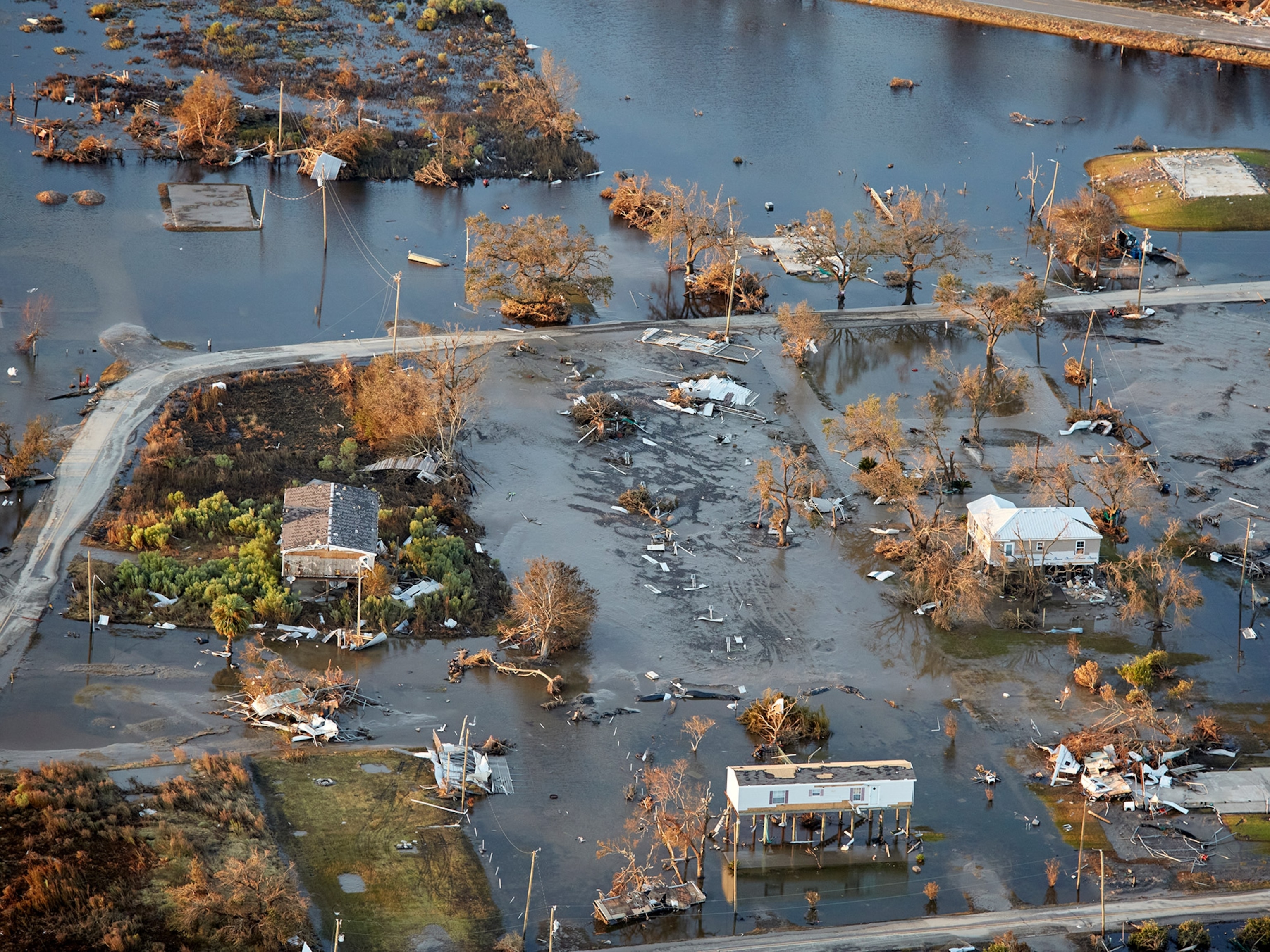
Canada and Mexico weren't so lucky, however. In Mexico, Hurricane Alex caused more than a billion U.S. dollars in damages in early July, and Hurricane Karl left thousands homeless in mid-September.
Canada's Maritime Provinces also took hits from hurricanes. After missing the U.S. coast, Hurricane Earl made landfall on Nova Scotia as a weakened tropical storm.
And in late September Hurricane Igor's winds reached 155 miles (250 kilometers) an hour as it churned across the Atlantic and turned toward Canada.
The storm stayed well off the U.S. coast and weakened as it moved northward, but Igor dealt a punishing blow to Newfoundland and Labrador (map) when it made landfall there on September 21. (See "Hurricane Igor Now Strongest Storm—But U.S. Spared Again?")
"Igor was the worst hurricane in memory in Newfoundland," Weather Underground's Masters said.
Related Topics
You May Also Like


Go Further
Animals
- Octopuses have a lot of secrets. Can you guess 8 of them?
- Animals
- Feature
Octopuses have a lot of secrets. Can you guess 8 of them? - This biologist and her rescue dog help protect bears in the AndesThis biologist and her rescue dog help protect bears in the Andes
- An octopus invited this writer into her tank—and her secret worldAn octopus invited this writer into her tank—and her secret world
- Peace-loving bonobos are more aggressive than we thoughtPeace-loving bonobos are more aggressive than we thought
Environment
- This ancient society tried to stop El Niño—with child sacrificeThis ancient society tried to stop El Niño—with child sacrifice
- U.S. plans to clean its drinking water. What does that mean?U.S. plans to clean its drinking water. What does that mean?
- Food systems: supporting the triangle of food security, Video Story
- Paid Content
Food systems: supporting the triangle of food security - Will we ever solve the mystery of the Mima mounds?Will we ever solve the mystery of the Mima mounds?
- Are synthetic diamonds really better for the planet?Are synthetic diamonds really better for the planet?
- This year's cherry blossom peak bloom was a warning signThis year's cherry blossom peak bloom was a warning sign
History & Culture
- Strange clues in a Maya temple reveal a fiery political dramaStrange clues in a Maya temple reveal a fiery political drama
- How technology is revealing secrets in these ancient scrollsHow technology is revealing secrets in these ancient scrolls
- Pilgrimages aren’t just spiritual anymore. They’re a workout.Pilgrimages aren’t just spiritual anymore. They’re a workout.
- This ancient society tried to stop El Niño—with child sacrificeThis ancient society tried to stop El Niño—with child sacrifice
- This ancient cure was just revived in a lab. Does it work?This ancient cure was just revived in a lab. Does it work?
- See how ancient Indigenous artists left their markSee how ancient Indigenous artists left their mark
Science
- Jupiter’s volcanic moon Io has been erupting for billions of yearsJupiter’s volcanic moon Io has been erupting for billions of years
- This 80-foot-long sea monster was the killer whale of its timeThis 80-foot-long sea monster was the killer whale of its time
- Every 80 years, this star appears in the sky—and it’s almost timeEvery 80 years, this star appears in the sky—and it’s almost time
- How do you create your own ‘Blue Zone’? Here are 6 tipsHow do you create your own ‘Blue Zone’? Here are 6 tips
- Why outdoor adventure is important for women as they ageWhy outdoor adventure is important for women as they age
Travel
- This royal city lies in the shadow of Kuala LumpurThis royal city lies in the shadow of Kuala Lumpur
- This author tells the story of crypto-trading Mongolian nomadsThis author tells the story of crypto-trading Mongolian nomads
- Slow-roasted meats and fluffy dumplings in the Czech capitalSlow-roasted meats and fluffy dumplings in the Czech capital
